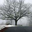
To the southeast of the village of Winchendon MA lies a cluster of steep-sided, flat-topped low hills composed of gravelly till deposited by the outwash of melting glaciers.
Over time running surface water has eroded channels in these deposits, leaving behind mesa-like formations of nutrient-poor soil that supports the growth of shrubby heath and some red pines, but little else. Dirt bikes and ATVs have worn tracks through the thin organic skin covering these little buttes into a bewildering maze of dusty, interconnecting trails. Even on a bright day, with the sun a beacon to the south, it's easy to get disoriented.
Despite its proximity to home, I've never really explored the area. I tramped it once many many years ago, and yesterday, while browsing through the maps in search of a place to hike, I thought a return visit might be in order. So after dropping off a few supplies for my mom at her assisted-living home (they're still under lockdown, and only allow for emergency visits), I drove a few miles down Route 12 from the village to North Ashburnham Road, from which the filigree of ad-hoc trails begins.
It starts out as a rough unpaved road skirting along the southern edge of one of the hills. About 3/4 of a mile in, it ends at the node of three ATV tracks. One of these ended abruptly where floodwaters had submerged it completely.
Another led downhill to the edge of the Millers River, where a snowmobile bridge crosses the water.
Despite its sketchy appearance, I ventured out onto the structure - but it felt just as sketchy underfoot as it looked, and I figured that 1/4 of the way across was as far as I wanted to go. I took a few pictures and tried unsuccessfully to capture audio of a bird known to me only by its call.
I returned to the node and followed the third track directly up to the plateau atop the hill.
My recollection was that a trail had run east-west along the top of the cliff, but if true, this wasn't it - it just doubled back on itself and returned to a few hundred feet of where it had begun. Since I'd gotten it into my mind to try finding Lake Sal (see map), I was going to have to bushwhack across the plateau and down the other side to pick up another trail. And since I've gotten one tick bite this year already, I wasn't keen on the idea of off-trail travel, but short of aborting the mission, I didn't see any alternative.
The sparseness of any understory made travel relatively easy, but I was paranoid about each and evey stray tickle I felt below my knees. Whenever I had to pass under low-hanging evergreen boughs, I'd give them a shake first to dislodge any arachnids lying in ambush. It was a relief to get out of the brush and onto an open track.
For a little over an hour I chugged along on a northerly heading, making note of every junction, one of which I had a strong intuition was a shortcut back to the trailhead. I made several side trips in hopes of finding even a modest vista, but none of them panned out. Then the trail descended into a swampy zone, where flooding sometimes forced me off-trail again to portage around pools blocking the way. It was starting to feel like work. Finally I reached a point I couldn't see a clear way around - a broad multi-stream sheet of water trickling down the hill on my right, met by standing water from the swamp on my left covering the road. I was done for the day.
For some reason, the return trip always seems shorter than the outbound - maybe because you're seeing everything for the second time, and the novelty is diminished. In short order I'd returned to the junction I suspected led directly to the trailhead - and it did, or close enough to it to count. I reached the car within 10 minutes of my original ETA.
FIrst order of business after returning home was a tick check followed by a hot shower. Cocktails had to wait.